
How can efficient water management help us cope with climate change?
Ask a farmer what they think of climate change, and you'll probably get an earful. Climate change is already impacting the ways in which we grow crops, and it's not always for the better. While rising temperatures may help some of us to grow more food in some places, this will likely be offset by other issues.
Published on 17 May 2023
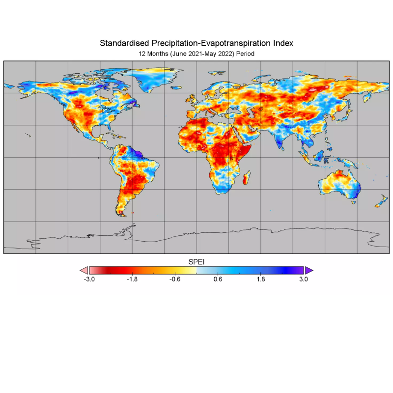
Climate change can lead to unpredictable weather patterns that make farming more challenging. According to NASA, future increases in atmospheric carbon dioxide could decrease crop nutritional value. So, what's an agriculture-dependent world to do? Well, one solution involves using satellites to precisely irrigate your field at the right time and with the right amount of water. In this blog, you’ll find out how it works.
Water scarcity in the era of climate change 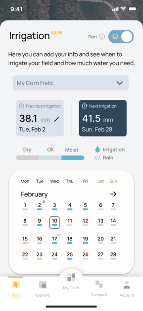
Water is an essential resource for agriculture. In the United States, agriculture accounts for about 80% of all fresh water use. This includes irrigation, cleaning and cooling, livestock production, processing and packaging products. However, with climate change, we won’t have enough fresh water for agriculture.
While some areas will always experience drought conditions—such as California or Australia—these problems are becoming more severe in other regions because of climate change-related factors such as increased temperatures and decreased rainfall. These changes can have devastating effects on agricultural industries, leading to significant economic losses if farmers cannot adapt to these new conditions by using more sustainable irrigation methods and high-tech agriculture information services in order to increase productivity while reducing water usage.
So how can we minimize the consequences of climate change on farming?
There are many ways to do this, but one of them is a technique called precise irrigation.
This means that farmers can use remote sensing and satellite imaging, which allow them to better understand their fields. If you know how much water is available for plant growth and when it will be needed, you can plan irrigation accordingly. Thankfully, Orbit will do it for you. The collected data comes from meteorological observations. The data helps researchers measure soil water content, and evapotranspiration – which is the amount of water that evaporates from plants. You will also need to know what the weather will be like. All of this information and forecasts will then be used in order to know when to irrigate your crops and how much water you need.
You said I need soil moisture, weather conditions, and evapotranspiration data
to schedule irrigation…
Monitoring soil moisture and weather conditions to determine when it is time for irrigation is important. But how do you do that? Thanks to remote sensing technologies, we can provide you exactly what you need. In our recently published feature on Orbit, you just have to enter your soil type, irrigation type and water conveyance line. In minutes, you will be able to learn when to irrigate your field and how much water you’ll need. You will also be able to track how vegetation and soil water content change in your fields over time.
The state of our environment is changing, and we can't afford to wait for a natural disaster to occur before thinking about what steps need to be taken. Climate change is having an effect on soil water content, which will severely impact agricultural productivity worldwide.
This is why you need to know how much water your fields need and when they need it in order to manage water effectively.
Thanks to developments in technology, you can stay one step ahead of climate change. You can grow crops more efficiently and sustainably while minimizing the impact of water scarcity. Orbit will help you manage your water and eventually save you money by minimizing your need for water and energy, and thus maximizing your profit.
For those interested in exploring how Doktar's innovative solutions can transform your agricultural practices, visit our website for detailed information on all our products. Stay updated with the latest developments by following us on Instagram and LinkedIn, where we share insights, tips, and updates about our technologies and their impact on modern farming.
Managing your water for irrigation has never been easier!
Download Orbit now and start using our irrigation feature!

Agriculture Technology and Data-Driven Harvests
The convergence of agriculture technology and data-driven solutions represents the next frontier of innovation in farming. With companies like Doktar leading the way, farmers can leverage these advancements to improve productivity, reduce environmental impact, and secure a more sustainable future for agriculture. Whether through precision agriculture, sustainable agriculture, or cutting-edge smart agriculture technology, the future of farming is bright, and data is at the heart of this transformation. Technology's positive impact on this future should inspire and motivate us all.

Integrating Crop Health Monitoring Systems for Better Farm Management
Crop health monitoring systems revolutionize modern agriculture by enabling real-time insights into plant health, reducing losses, and promoting sustainability. Tools like Doktar’s CropMap and Orbit integrate advanced technologies, empowering farmers with data-driven decisions. By enhancing efficiency and sustainability, these systems are essential for future-proofing agricultural operations.

Modern Agriculture: Innovative Solutions to Combat Global Food Insecurity
Modern agriculture combats global food insecurity with precision agriculture, sustainable practices, and biotechnology. Tools like IoT, automation, and crop innovations optimize resource use, enhance resilience, and ensure stable food supplies. By integrating smart technologies, agribusinesses address challenges like climate change and resource scarcity, paving the way for a sustainable food future.